VizExperts GeorbIS 3D Maps Presentation
Characteristics
- From data to decisions
- Leveraging GeoInt
- GeorbIS- Make in India
- Proven across critical deployments
- DGS&D rate contract
Fully integrated solutions
- 3D GIS portals
- 3D geo-database creation
- Data fusion and analytics
- Local support and service
- Custom application development
GIS Signature Projects – Transformation


Recent Posts
Partners

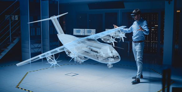
3D Maps A Geo intelligence Application
- A particular kind of Map in which territorial data have not only X and Y coordinates for geographical location but also the Z coordinate to represent the altimetry.
- 3D maps are a map-related representation, not only a map in the classic sense.
- 3D Mapping bring maps to life with realistic views of locations, buildings and roads.
- This technology has revolutionized the mapping world.
- Computer generated perspective views, often simply referred to as “3D maps” Although this term is not found in the cartographic literature,
- 3D Maps is in on –demand because; “ We perceive the presented landscape with our human perception system in a 3D perspective way, even when the landscape is depicted on 2D.
Why 3D Maps ?
3D Maps Supports
- Object recognition
- More accurate path planning
- More reliable localization & data association.
- Navigation on uneven terrain
Benefits
- Vertical information
- Intuitive symbology
- Powerful and intuitive visual analysis
- Shows real-world, bird’s-eye views
- 3D allows the viewer to immediately orientate themselves as to where they are in relation to the map.

Comparison Between 3D Maps And 2D Maps

- 2D Maps are two dimensional. These maps result in a flat or traditional representation of area of interest.
- 3D maps depict the length, width, and height of facilities and landmarks of area of interest

- 3D Maps can be illustrated in vector style or a combination of vector and real photographic images
- 3D Maps feature a 360 degree representation of your Area of Interest . Online viewers can then take a virtual tour over there.
Give the Power of 3D Maps to your project
Schematic Design Process For 3D maps


Application Areas of 3D Maps
Put Your Business On The 3D Maps
The evolution of 3d mapping is rapidly growing and now there are many applications that use it, especially in surveying and material monitoring
- Incorporating 3d mapping into your business model can expand the flexibility of your business and highlight high-tech services.
- 3D mapping can even be used to save time and money.
- 3D mapping is beginning to shift toward a merge with virtual reality
- Give users the ability to experience an environment in real time from the comfort of their home, office or from any location.
- Let them Making their Decision through 3D Visualization
There are endless uses for 3d mapping, but we listed a few areas where the technology has proven invaluable


City Planning
- 3D Maps allow architects, planning engineers and others to collaborate effectively.
Archaeology
- 3d Maps is used in rendering and recreating forgotten civilizations and architectural
Astronomy
- 3D Maps is used to represent space with three-dimensional creations of stars, planets and galaxies.
Irrigation Water Management
- Identifying suitable areas for cultivation
- Irrigation system performance evaluation
- Option to populate forests through a polygon vector layer
Tourism management
- Provide 3D View area of cultural interest
- Planning new tourist spot
Forestry
- Identify critical areas at risk
- Analyze fire damage
- Develop rehabilitation plans.
Disaster management
- Provide 3D information to emergency responders
- Provide safe rescue path for evacuation
Utility sector
- Asset and network management
- Planning and analysis
- 3D Visualization & Design Optimization
Defense and Crime management
- Provide 3d Visualization for ops planning
- Provide optimum and safe routs
- 3D Visualization & Design Optimization
Decision-making with 3D-Maps
Decision-making capabilities
- Provide 3rd dimension information for decision-making
- Provide 3D Maps as visual analytics tool
- 3Map any location in the world
- Need height information.
Spatial Question Solution
- Answer Which or Where with Height
- Location of interaction devices
- 3D map, 3D Map Chart

UAV for producing 3D Maps

- Capture actual ground image with 360 degree & 90 degree tilt
- Autonomous and man- portable quad copter