VizExperts Visual Computing Solutions
VizExperts Visual Environments
- Multi-domain integration platform
- Immersive visualisation
- 3D Projection based systems
- Multi-megapixel display real estate
- Single desktop technology
- Ideal for 1:1 scale projection
- Varying immersion levels
- 45° – 360° based on the application</li

VizExperts VizDisplay
- Multi input, multi output processing
- Auto source recognition
- Completely configurable
- Resolution, format independence
- Built in source recording, archival
- Auxiliary display control
- Wireless iPad controller
- Mini-vu previewer
- Simplified installation
- Easy trouble shooting

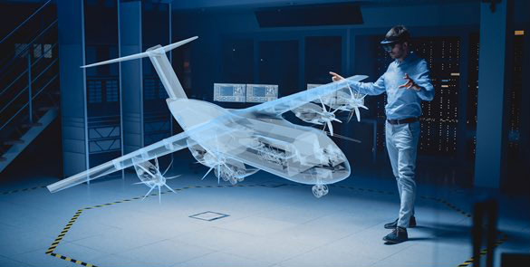
VizExperts Virtual Reality Solution
- Enhancing presence from CAD to VR
- Immersive 3D content development
- In-house integration modules
- Custom interface with COTS tools
- Remote rendering of 3D content
- Experience with VR gadgetry
- Wand, Gloves, Haptics, HMD, Mocap

For more information on our solutions
Recent Posts
Partners


Addressing The Complete Multi-domain Virtual Product Lifecycle

GeorbIS GIS Solutions


GeorbIS Feature
- Indigenous 3D geospatial engine
- Certified OGC compliant
- Agile terrain data processor
- Windows and Linux options
- 3D analytics toolkit
- CartridGIS for modular extensions
Advantage GeorbIS
- Highly modular
- Open architecture
- GPU accelerated performance
- Desktop performance over web
- Mobile application development
- Certified OGC compliant
- WCS, WMS, WFS, WFS(T)
- Increased interoperability
- No vendor lock-ins
GeorbIS CartridGIS
- Poll Star – For integration of DGPS survey data
- Analyst – For complex 3D analytics
- G-Shift – For GPU accelerated geoprocessing
- Processor – For terrain creation
- Intel – For military intelligence
- Footprint – For unit tracking and GPS data integration
- Stratagem – For mission briefing and operation planning
GeorbIS Complete Integration
- Enterprise server for wide access
- Multi-database integration with GIS
- Map data collaboration framework
- Optional Incident management system
- Alert/ warning notification
- Asset management and recovery
- Optional Integration with other dynamic data inputs
- Video
- Vehicle Tracking
- Mobile calls and messages


Integrated Operation Centers


Seamless Displays
- Infrastructure
- Multi-megapixel displays
- Certified 24/7 operational
- 2D/ 3D projection based systems
- 2D/ 3D video/ data walls
- Infostructure
- Geospatial decision support
- Sensor data integration
- Applications across
- Control rooms
- Network operation centre
Integrated Consoles
- Dedicated Ergonomic Seating
- Integrated Audio and Equipment
- Inbuilt Connectivity Ports
- Centralized Equipment Control

Remolding The Sand Model Digitally


All digital Workflow
- Modern sand model technology
- OGC certified engine
- Uses the best of
- 3D GIS
- Simulation, gaming concepts
- AV, Interaction devices
- Ideal for
- Sand model training
- Mission briefing
- Operation planning
- Tactical field expedient
Advantage Digital
- No more toys, sticks, sand mould
- Real time collaborative planning
- Multi-touch interaction
- Time vantage of satellite imagery
- Organization specific customization
- Accurate analytical tools
- Intuitive UX design
The Next Dimension In Simulation


GeorbIS GIS Simulation
- Home grown 3D simulation engine
- Built around interoperability
- OGC certified geospatial foundation
- GeorbIS 3D GIS platform
- WCS, WMS, WFS and WFS (T)
- Support for HLA
- Built in library
- Computer Generated Forces (CGF)
- Entity models
- Support desktop and web platforms
- Robust, proven platform
Invizta
- Scenario playback and review
- Multi window viewing
- Navigation from any vantage point
- 2D/ 3D view toggle
- 2D for COP/ Command level view
3D for entity level view - Support for overlaying real time video/ photographs
- Visual analytics toolkit
- Trails, targets, sensor volume
Resource optimisation, risk analysis
Scenarium
- Fully featured scenario creator
- Entity models with entity editor
- Radar, telemetry, other sensors
Weapons, communication
Weather, environment - Specific simulation models for real time/ turbo time game play
- Report generation framework
- Simulation configuration utility
- Support for desktop and web
Invizta: Sensurge
- IR, NV, EOTS visualisation module
- Light energy modeling
- Physically accurate illumination
- Atmospherics
- Signature reflected/ emitted from surface
- 250 real world material library
- Spectral Bidirectional Reference Distribution (BRDF)
- Bulk thermal data